Maps Page on
Argentina
Outline
·
Physical Environment
o Soil
Types of Argentina
o Andes Mountains: Mountain System, South
America (Argentina)
o Map of Rivers in Argentina
·
Weather & Climate
o Köppen-Geiger
Climate Classification Map for Argentina (1980-2016)
o Precipitation Map of Argentina
o Wind
Pattern Map of Argentina
·
Human Environment
o Population
Density Map of Argentina
o Median
Monthly Salary Map of Argentina
o Human
Development Index Map of Argentina
·
Road maps
o First
Road Map of Argentina (Major Roads)
o Second
Road Map of Argentina (Major and Minor Roads)
o Third
Road Map of Argentina (Provincial Boundaries)
·
City Maps
o First
City Map of Argentina (Buenos Aires)
o Second
City Map of Argentina (Downtown Buenos Aires)
o Third City Map of Buenos Aires (Hotels)
·
Urban Transportation Maps
o First
Urban Transportation Map of Argentina (Main Buenos Aires Bus Routes)
o Second
Urban Transportation Map of Argentina (Buenos Aires Metro System)
o Third
Urban Transportation Map of Argentina (Buenos Aires Bicycle Routes)
·
Tourist Maps
o
First Tourist Site Map of Argentina
(Palermo Neighborhood, Buenos Aires)
o Second
Tourist Site Map of Argentina (Top 10 Tourist Sites, Buenos Aires)
o No
third tourist map included
1 Physical Environment
Soil
Types of Argentina Map:
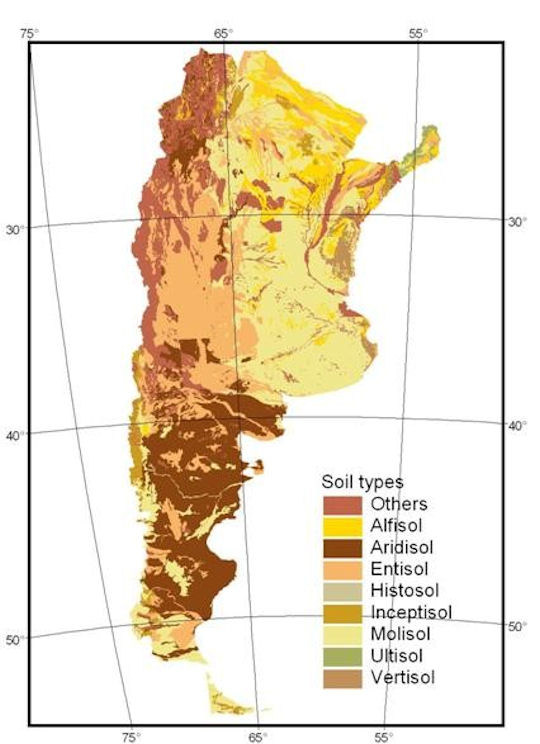
This
first physical environment map of Argentina depicts the different types of soil
that are found throughout the country. According to this map, the three main
soil types that are found in Argentina include Mollisol,
Aridisol and Entisol.
Map’s
website address:
Andes
Mountains: Mountain System, South America (Argentina):
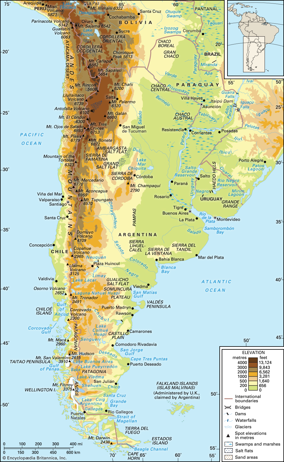
This
second physical environment map depicts the location and different levels of
elevation within the Andes Mountains beginning in Argentina before going north
into Bolivia and Peru. The map also depicts the locations of several high
mountain peaks in western Argentina on or near the border with Chile.
Map’s
website address:
https://www.britannica.com/place/Andes-Mountains
Map
of Rivers in Argentina:
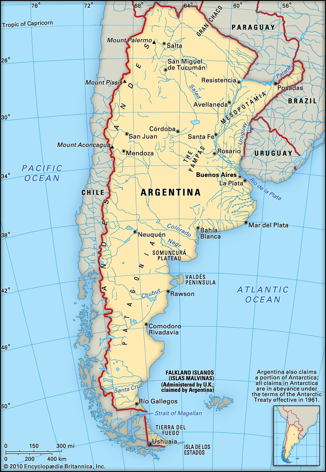
This
third physical environment map shows all of the rivers that flow throughout
Argentina. According to this map, the main rivers that flow throughout the
country include the Salad, the Colorado, the Negro, the Chubut and the Santa
Cruz Rivers.
Map’s
web address:
https://cdn.britannica.com/77/62377-050-DE557812.jpg
2 Weather & Climate
Köppen-Geiger Climate Classification Map
for Argentina (1980-2016):
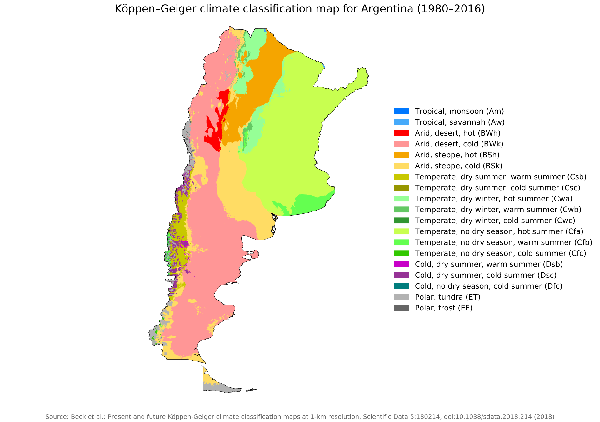
This
first weather and climate map of Argentina depicts the different types of
climate classifications throughout the country. Two predominate climate
classifications on this map include temperate with no dry season and hot
summers in the northeast along with an arid, desert region with cold
temperatures stretching from the northwest to the deep south.
https://en.wikipedia.org/wiki/Climate_of_Argentina
Precipitation Map of Argentina:
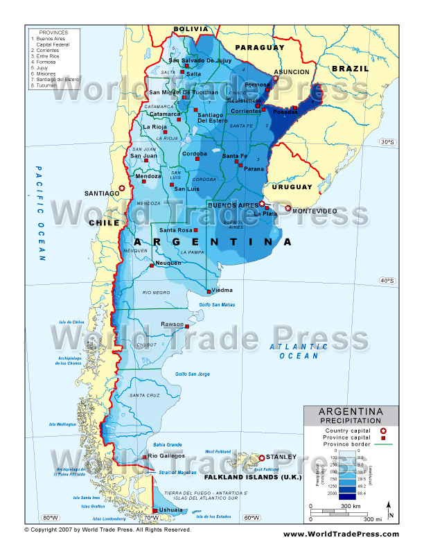
This
second weather and climate map shows the average amounts of precipitation that
the various regions of Argentina receive each year. According to this map, the
areas that get the highest amounts of precipitation are the east and northeast
and the areas that get the lowest amounts are the south and northwest.
Map’s
website address:
http://www.stockmapagency.com/Precipitation_Map_Argentina_C-Arge-2007-Precip.php
Wind
Pattern Map of Argentina: 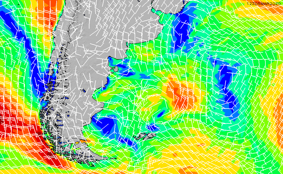
This
third weather and climate map depicts current wind patterns in and around
Argentina. According to this map, in the northern region of the country, winds
seem to be blowing north before turning towards the east. Meanwhile, in the
south, winds appear to be coming from the east before blowing north into the
country’s southern region.
Map’s
web address:
https://www.surfline.com/surf-charts/regional-wind-gfs/argentina/58581a836630e24c44879023
3 Human Environment
Population
Density Map of Argentina:
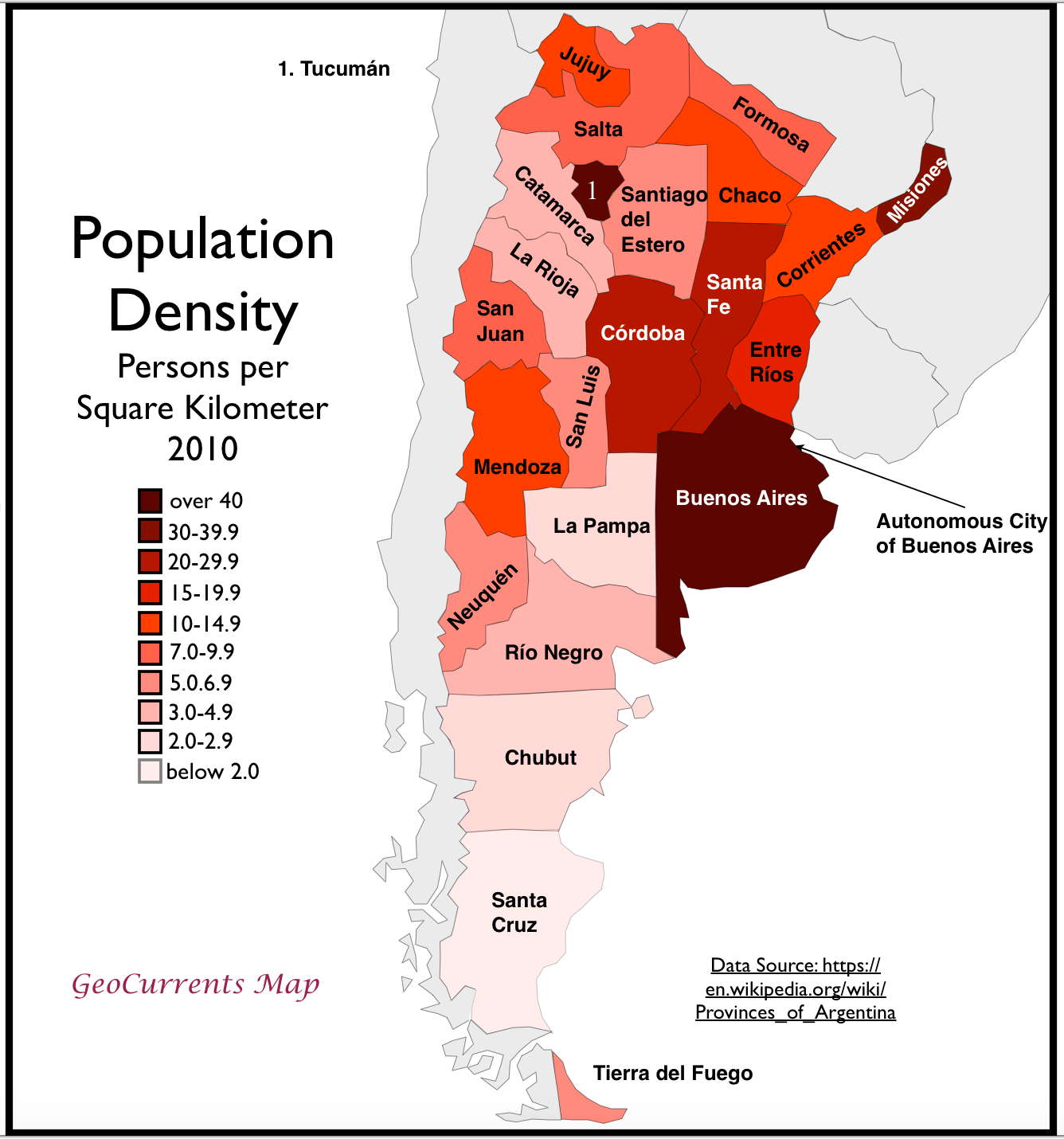
This
first human environment map shows the population density of Argentina per
square kilometer as of 2010. Population density ranges are given for each of
the country’s provinces. According to this map, the provinces that have the
highest population densities include Buenos Aires, Misiones and Tucuman. In
contrast, the provinces that have the lowest population densities include La
Pampa, Chubut and Santa Cruz.
Map’s
web address:
Median
Monthly Salary Map of Argentina:
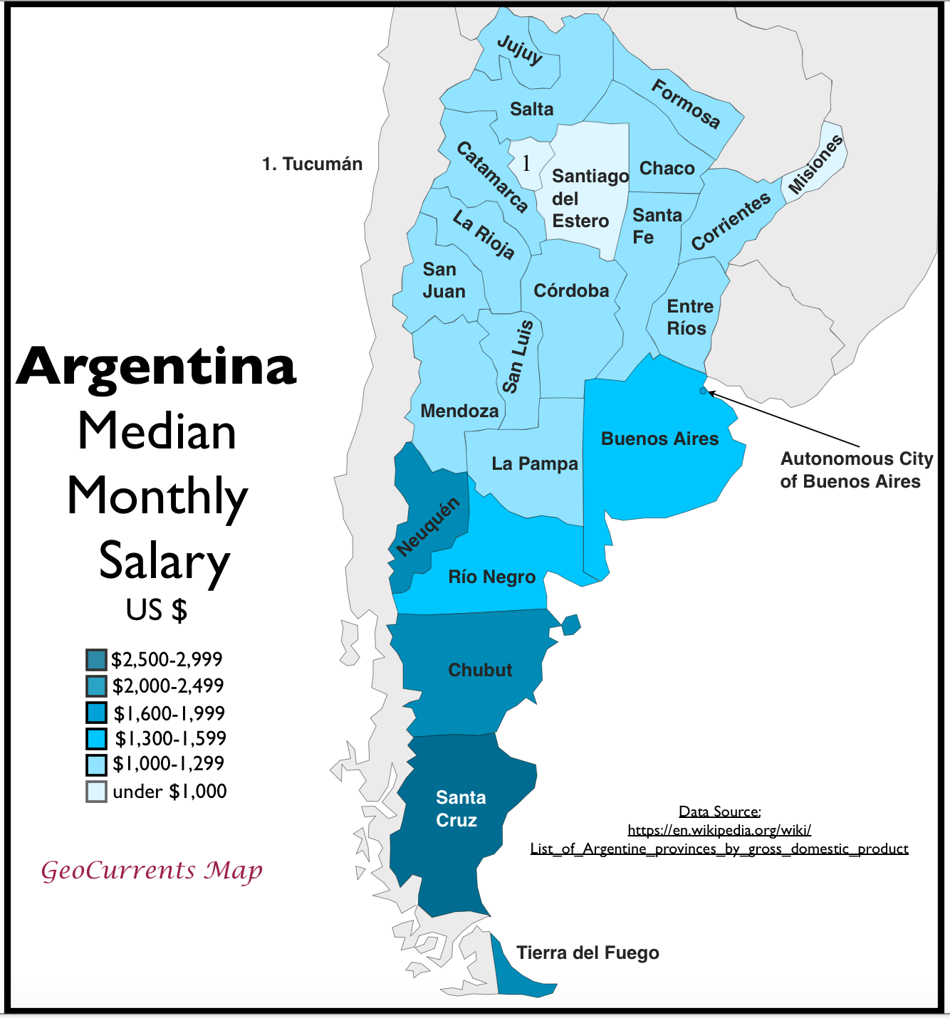
This
second human environment map shows the median monthly salary of Argentinians by
province in USD. According to this map, the provinces who’s population makes
the most money per month include Neuquén, Chubut, Tierra del Fuego and Santa
Cruz. In contrast, the provinces who’s population makes the least money per
month include Santiago del Estero, Misiones and Tucuman.
Map’s
web address:
http://www.geocurrents.info/economic-geography/argentinas-striking-northsouth-economic-divide
Human
Development Index Map of Argentina:
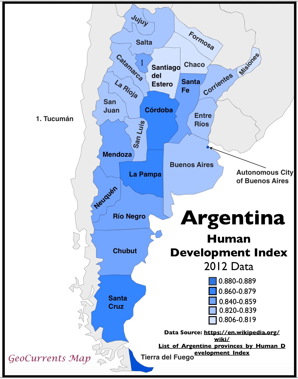
This
third human environment map depicts different levels of human development in
each province of Argentina. According to this map, the provinces that have the
highest levels of human development include Tierra del Fuego, Santa Cruz, La
Pampa and Cordoba. In contrast, the provinces that have the lowest levels of
human development include Santiago del Estero, Chaco, Formosa and Misiones.
Map’s
web address:
http://www.geocurrents.info/economic-geography/argentinas-hdi-the-wikipedias-worst-map
4 Road Maps
First
Road Map of Argentina (Major Roads):
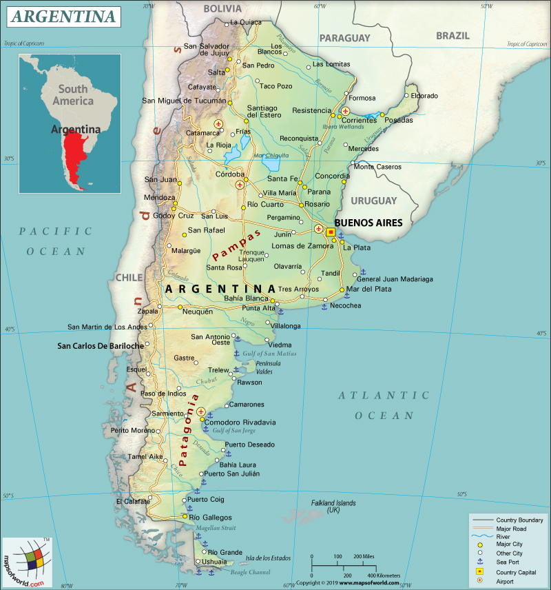
This first road map of Argentina shows the major roads that stretch
across the country. The roads are mapped out in reference to their location
near major cities.
Map’s web address:
https://www.mapsofworld.com/answers/geography/what-are-the-key-facts-of-argentina/
Second
Road Map of Argentina (Major and Minor Roads):
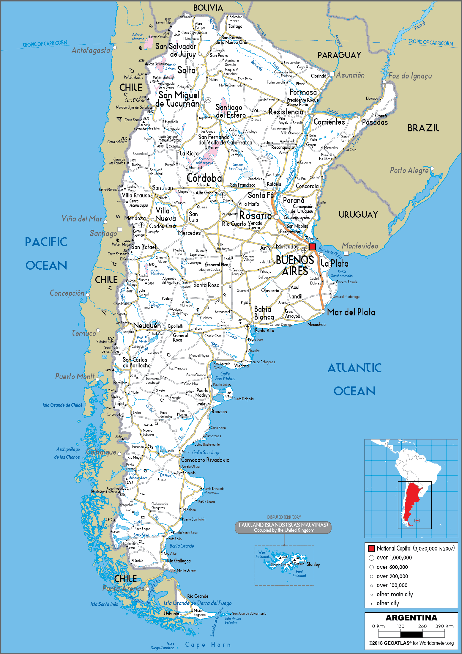
This
second road map of Argentina shows both major and minor roads that stretch
across the country. The roads are mapped out in reference to their locations
near major cities as well as Argentinian provinces (without provincial boundary
lines shown).
Map’s
web address:
https://www.worldometers.info/maps/argentina-road-map/
Third
Road Map of Argentina (Provincial Boundaries):
This
third road map of Argentina goes back to only showing the major roads that
stretch across the country. However, the major roads are mapped out in
reference to how they stretch across provincial boundaries in addition to their
locations near major cities.
Map’s
web address:
https://legacy.lib.utexas.edu/maps/americas/argentina.jpg
5 City Maps
First
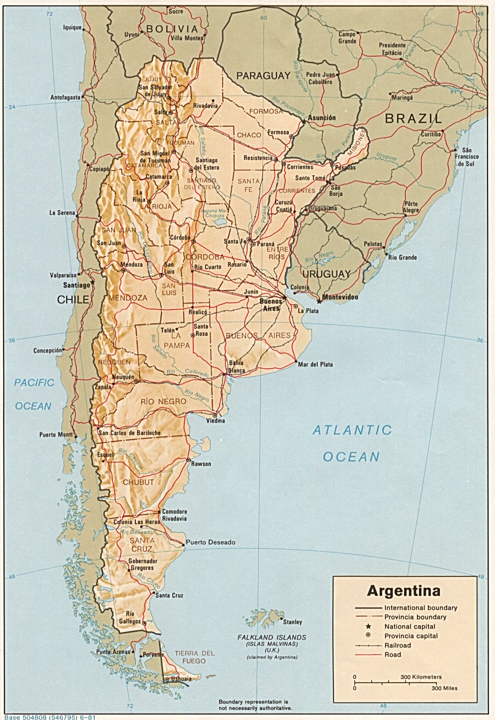
City Map of Argentina (Buenos Aires):

This
first city map shows all of the roads in Buenos Aires, Argentina. This map
offers a thorough layout of the city, showing all major roads, neighborhoods,
infrastructure, parks, shopping centers and more. This map is useful as it
gives the tourist a good idea of how the transportation system of the city is
designed in addition to giving information on what there is to do in the city
for entertainment.
Map’s
web address:
http://www.orangesmile.com/travelguide/buenos-aires/city-maps.htm
Second
City Map of Argentina (Downtown Buenos Aires):
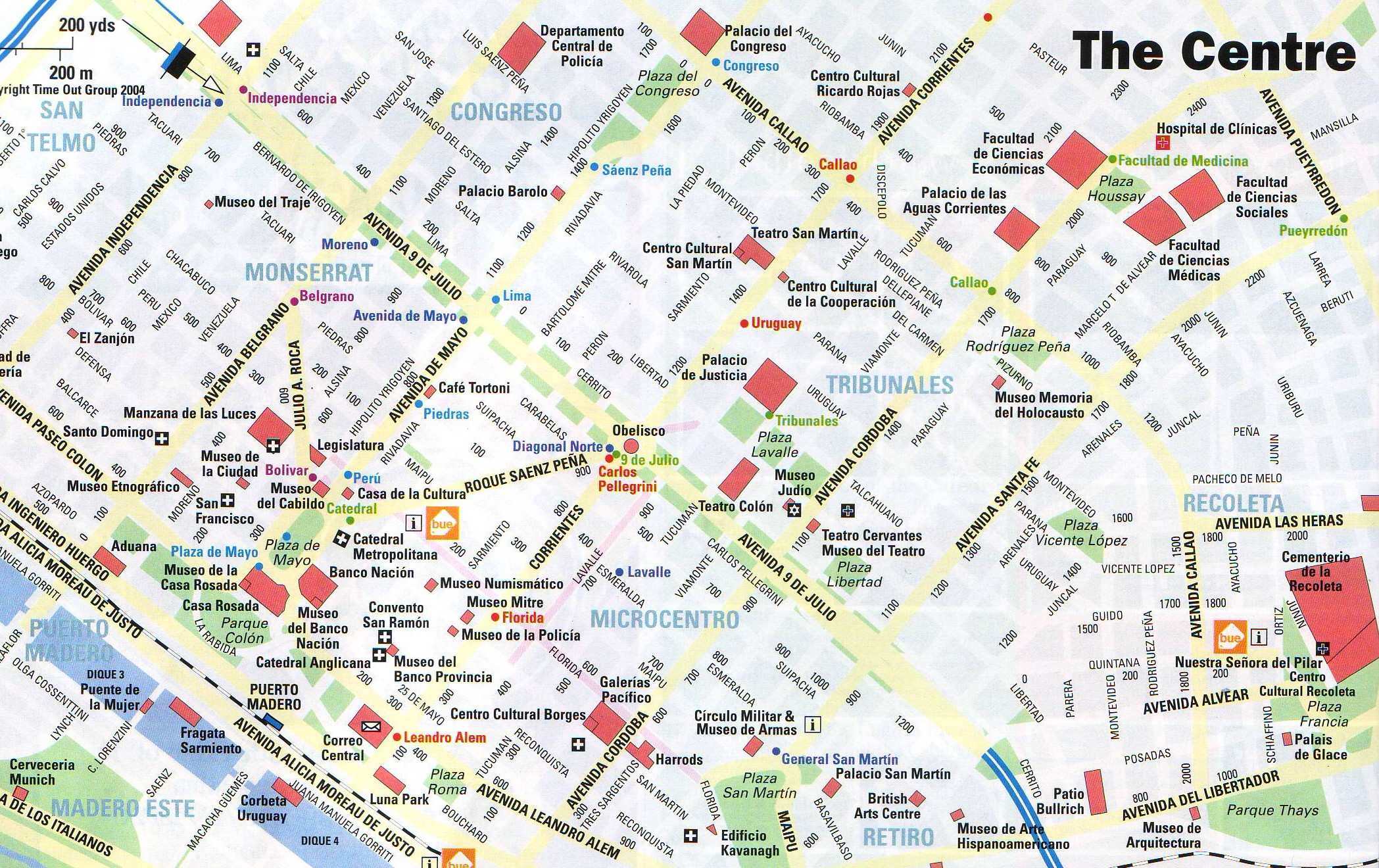
This
map shows specifically the downtown area of Buenos Aires. It gives names of
major and minor roads in downtown Buenos Aires as well as specific information
on entertainment opportunities such as museums and entertainment plazas. This
map is important as downtown areas of travel destinations often draw tourists
for cultural and entertainment experiences.
Map’s
web address:
http://www.orangesmile.com/travelguide/buenos-aires/high-resolution-maps.htm
Third
City Map of Buenos Aires (Hotels):
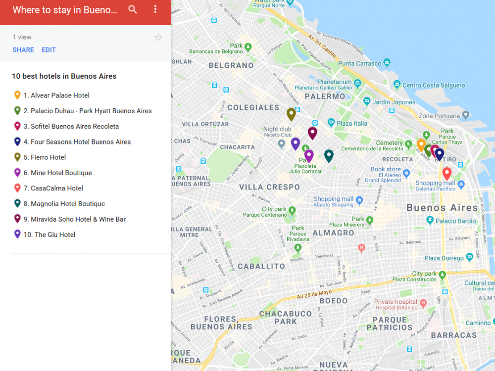
This third city map of Buenos Aires shows where the top 10
hotels in the city are located. This map is useful as it offers information on
the best places to stay in Buenos Aires. In addition, it is always important to
know where the most comfortable places to stay are while on a trip in a foreign
destination.
Map’s web address:
http://guidora.com/where-to-stay-in-buenos-aires/map-7/
6 Urban Transportation
First
Urban Transportation Map of Argentina (Main Buenos Aires Bus Routes):
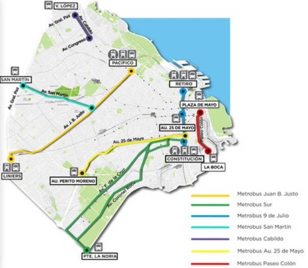
This
first urban transportation map of Buenos Aires shows the city’s main bus
transportation routes. It shows what general areas of the city the buses travel
through. This map would be necessary to have in the case of a tourist
preferring to travel through the city by bus instead of using the metro system.
Map’s
web address:
https://en.wikipedia.org/wiki/Metrobus_(Buenos_Aires)
Second
Urban Transportation Map of Argentina (Buenos Aires Metro System):
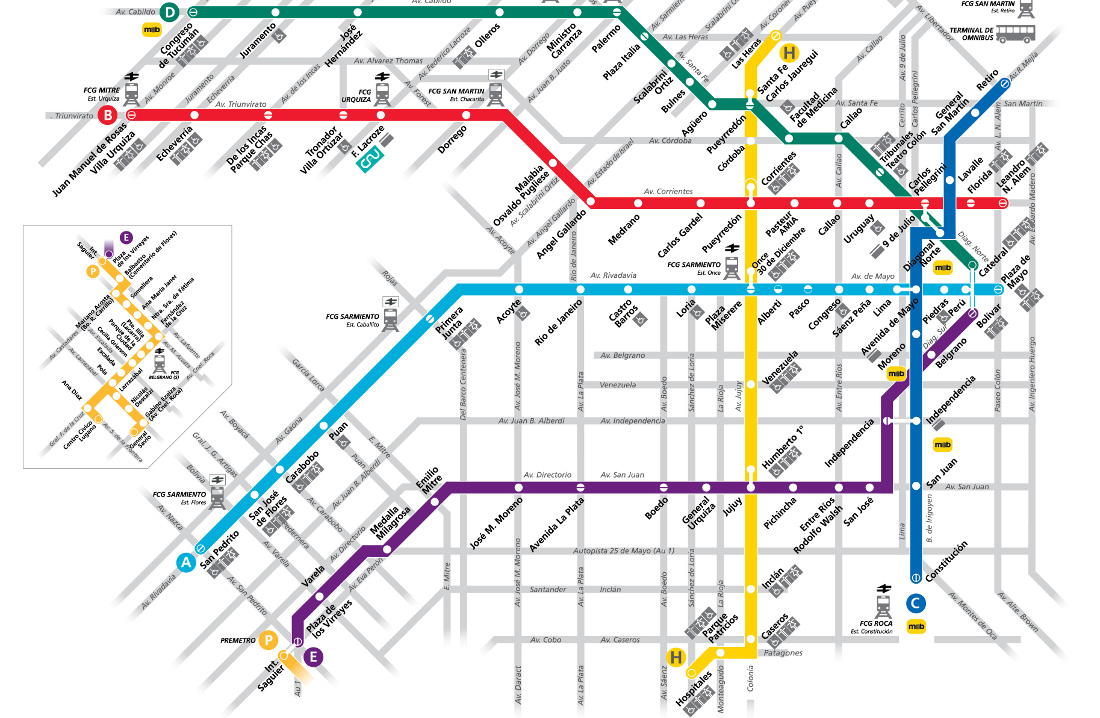
This
second urban transportation map shows the Buenos Aires metro system. This map
is necessary as it would help the tourist figure out the perhaps cheapest and
most efficient ways to get around the city rather than spending extra money on
taxis.
Map’s
web address:
https://www.stadiumguide.com/city-guides/buenos-aires-football-guide/
Third
Urban Transportation Map of Argentina (Buenos Aires Bicycle Routes):
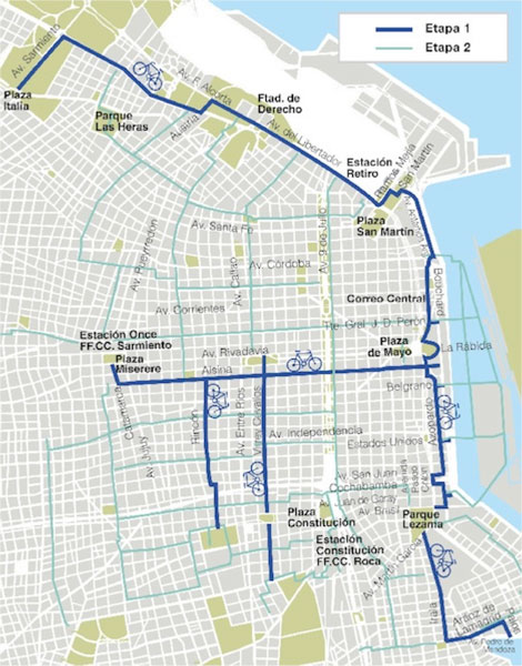
This
third urban transportation map of Argentina shows various bicycle routes that
stretch throughout Buenos Aires. This map would be useful to the tourist that
prefers to travel through the city with virtually no cost at all. Thus, they
choose to explore the city on bike rather than spending money on taxis or
taking advantage of the metro system.
Map’s
web address:
https://www.gringoinbuenosaires.com/biking-buenos-aires/
7 Tourist Sites
First
Tourist Site Map of Argentina (Palermo Neighborhood, Buenos Aires):
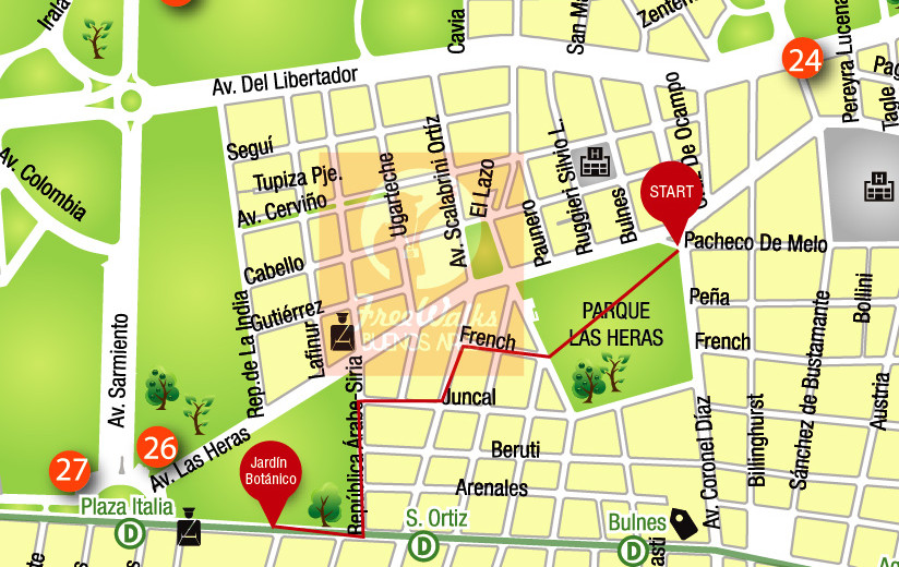
This
first tourist site map of Argentina shows the Palermo Neighborhood in Buenos
Aires. Palermo is the biggest neighborhood in Buenos Aires and is considered a
well-known tourist destination in the city.
Map’s
web address:
https://www.buenosairesfreewalks.com/buenosairestips/palermo-walk/
Second
Tourist Site Map of Argentina (Top 10 Tourist Sites, Buenos Aires):
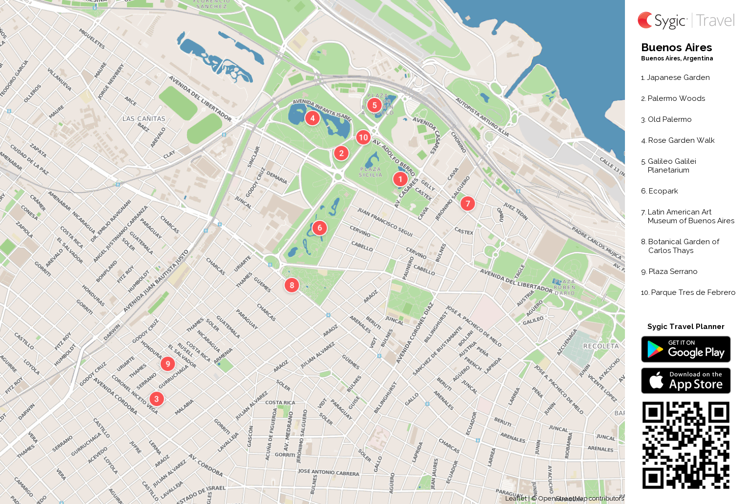
This
second tourist site map of Argentina shows the top 10 best sites to see while
visiting Buenos Aires. This map is important as it gives the tourist a good
idea of where to start enjoying all of the tourist destinations the Argentine
capital has to offer them during their stay.
Map’s
web address:
https://travel.sygic.com/en/map/buenos-aires-printable-tourist-map-city:374
Submitted by Spence Bridgman on 3/6/20.